« Observation techniques and analysis methods for water management in Mediterranean agricultural watersheds »
Organization
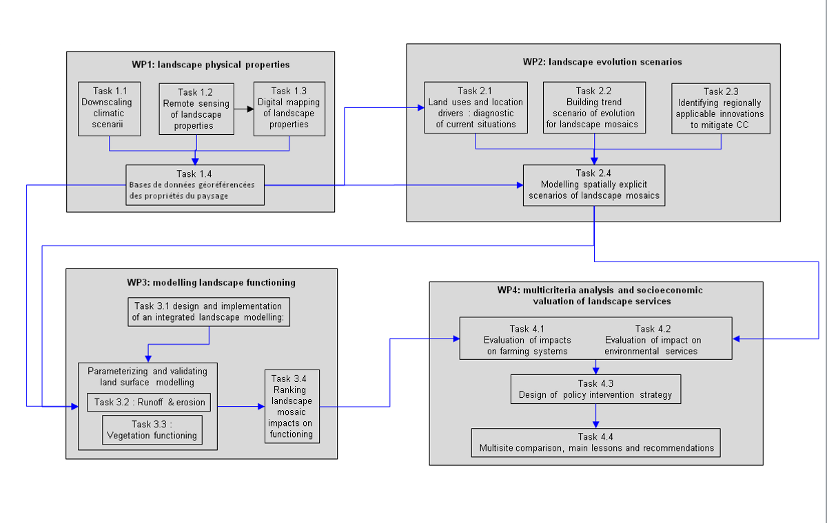
ALMIRA includes six workpackages (WP) and sixteen tasks that are clearly linked to each other.
We define four workpackages in relation to the involved thematics, along with two additional workpackages that aims to increase the project efficiency in terms of
animation and dissemination.
- Workpackage WP0 is devoted to scientific coordination and project organization.
- Workpackage WP1 designs and uses methods to characterize climatic scenarii and to characterize the landscape properties that drive soil and water fluxes. This involves
climatology, remote sensing, spatial statistics and GIS technology. - Workpackage WP2 aims to formulate spatially explicit scenarii of landscape mosaics from the agricultural field to the resource governance catchment, including structures,patterns and connectivities modulated by cropping systems. Landscape evolution isforecast by including innovations in cropping systems.
- Workpackage WP3 develops a process based modelling approach to simulate landscape functioning, including runoff, erosive fluxes and crop functioning.
- Workpackage WP4 relies on outputs from the three previous WP, to translate landscape functioning into landscape services through an economic valuation, to analyse landscape services in accordance to the foreseen evolutions, and to identify new action levers for the management of Mediterranean Rainfed Agrosystems.
- Workpackage WP5 aims to disseminate the project outcomes through various means.
Flowchart of ALMIRA and related workpackages
including links between tasks
(Click to enlarge image)
 |
|
|
|